Marion County
Rim Shoals Trail
- From U.S. Hwy. 62/412 in Gassville, turn south onto Red Bud Road and travel 443 feet.
- Turn left onto Buford Cutoff and travel 2.1 miles.
- Continue onto County Road 4 for 0.8 miles.
- Turn right onto Rim Shoals Road and travel 1.3 miles;
- Turn left onto Rim Shoals Lane and travel 0.3 miles to the parking area.
or
- From U.S. Hwy. 62/412 west of Mountain Home:
- Turn south on Highway 126 and travel 3.2 miles;
- Turn right onto Buford Cutoff Road and travel 1.5 miles;
- Turn left onto Rim Shoals Road and travel 1.3 miles;
- Turn left onto Rim Shoals Lane and travel 0.3 miles to the parking area.

Quick Facts
Maps
Important Numbers
Pulaski County EMS
911
Pulaski County Sheriff’s Office
501-340-6600
AGFC Little Rock Headquarters
833-345-0325
Stop Poaching Hotline
833-356-0824
About
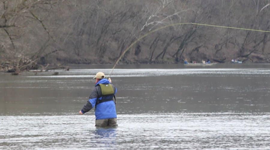
Once famous among smallmouth bass anglers, the White River is known around the world for trout fishing. Water released from the bottom of Bull Shoals Lake, 24 miles upstream, is too cold for native fish but is perfect for trout. Anglers pursue rainbow, brown, brook and cutthroat trout in every season. This trail provides access to the food-rich riffles and long, deep pools of the tailwater.
Nature lovers and anglers enjoy walking along the river for its sights and sounds – redbuds and dogwoods bloom along bluff lines in spring and cool air rising from the river helps beat summer heat. Reds and yellows of fall foliage paint the landscape, and migratory waterfowl add to the allure of the Ozarks.
Trail’s Past
Anglers have been walking the wooded shoreline at Rim Shoals for many years. Gary Flippin, owner of Rim Shoals Resort and a former railroad engineer, was concerned that anglers walking along the railroad tracks didn’t have a safe exit when the river rose quickly. Flippin talked to property owner Hugh McClain about donating the land to the Arkansas Game and Fish Commission, which McClain did in 2019. Donations from McClain and Trout Unlimited, plus a grant from the Frank Graham Memorial Endowment, were used to build the trail.
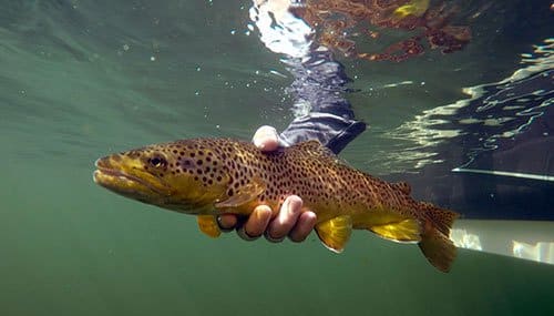
Rainbow, brown, cutthroat and brook trout live in the clear, cool water of Bull Shoals Lake tailwater. Although trout are not native to Arkansas, the state is famous for trout fishing. Hundreds of thousands of trout are stocked in the White River each year. Some anglers strive to catch an “Ozark Slam” – all four trout species in a day.
Trout often face upstream to feed on aquatic insects and small fish. Fishing with wet and dry flies are popular techniques. Anglers choose their flies to match a stage of an insect’s life – a nymph below the surface to an emergent adult on the water’s surface. Throwing streamers that mimic baitfish, crayfish and large insects such as hellgrammites also is effective.
The Bull Shoals tailwater offers riffles with runs and pockets, and plenty of flatwater and deep pools, too. Knowledge of fluctuating water levels is crucial for a safe trip. Visit a local fly-fishing store for advice and search out a local guide to explore more than 90 miles of trout water below the dam.
Check current regulations and learn more about fishing in the Bull Shoals tailwater here.
Anglers wading in the tailwater fisheries need to plan for rapidly changing water level. The UACE releases water from Bull Shoals Dam to meet the various needs of flood control, hydropower, navigation, fish and wildlife, municipal and industrial water supply, and recreation. Conditions in the lake and downstream of the dam help dictate how much and when water is released from the dam.
Rim Shoals is 24 miles downstream from the dam and it typically takes several hours for the water to reach this site. Warning horns from the dam cannot be heard at Rim Shoals.
The USACE and the Southwestern Power Administration have developed several resources to provide anglers with information about ongoing and upcoming releases.
Despite these resources, anglers should be aware that water release is subject to change at any time. Pay attention to your surroundings – mark a spot on the bank to gauge the water’s rise – and leave adequate time to exit the river if conditions change.
- SWPA Generation Schedules
Predicted generation schedules are posted daily around 3:00 p.m. The website uses the “Hour Ending” notation for hourly periods. Example: Under the “HR” column, the row “8” would be predicted generation from 7 a.m. to 8 a.m. (https://www.swpa.gov/generationschedules.aspx) - USACE Little Rock App
Links to the latest stage and flow rates and SWPA generation schedules. - By Phone
Current generation conditions: 870-431-5311
Projected generation conditions: 866-494-1993
Bull Shoals tailwater is prime territory for wildlife watchers. Listen for the high-pitched chatter of wintering bald eagles as they hunt or scavenge for food. Small but mighty, the sleek-bodied mink hunts along the water for fish, frogs, crayfish and insects.
Warblers, brightly colored migratory songbirds, wing their way north from the tropics each spring to breed in Arkansas and throughout North America. The black-and-white warbler is easier to spot than other warblers – watch them foraging for insects along tree limbs and listen for their squeaky wheel song.
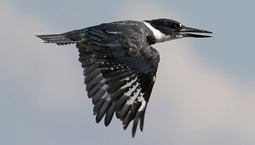
Belted kingfishers energetically patrol the river’s shoreline. They have a piercing rattle and build burrows in earthen banks. Cavities in trees make perfect nests for wood ducks, which are known to lay their eggs in another wood duck’s nest. River otters are excellent swimmers and divers, and dine on slow-moving fish, crayfish and frogs. Watch for their slides along the water’s edge.


