Arkansas River levels may cause flooding of Lake Conway, Lake Atkins homes
ON 05-28-2019
May 28, 2019
Randy Zellers
Assistant Chief of Communications
LITTLE ROCK — An increased potential for flooding exists for residences around Craig D. Campbell Lake Conway Reservoir in Faulkner County and Lake Atkins in Pope County this week.
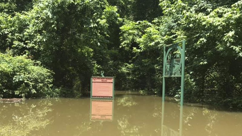
According to the latest predictions from the National Weather Service, the Arkansas River is expected to crest at 285.5 feet (mean sea level) at Toad Suck Lock and Dam June 3. This far exceeds the 1990 flood elevation and is expected to cause historic flooding. As of 8 a.m., Wednesday the extremely high water of the river has pushed water up Palarm Creek and back over the spillway at Lake Conway dam.
An event of this circumstance and magnitude has never occurred on Lake Conway, so it is unclear exactly how this backflow from the Arkansas River will impact the water level of Lake Conway. However, 2 to 3 inches of rain is predicted for portions of the Arkansas River Valley in eastern Oklahoma and northwest Arkansas later this week. These rains are expected to keep the Arkansas River very high for an extended period of time, increasing the flood risk for Lake Conway.
Prior to the river’s rise, the Arkansas Game and Fish Commission conducted a one-foot drawdown of Lake Conway to provide additional flood water storage. Releasing water from Lake Conway will be impossible until the water level subsides. Flooding of Lake Conway will be dictated by how much water backflows into Lake Conway from Palarm Creek, how much water flows into the lake from rain within Lake Conway’s watershed, and how long the river level remains too high to discharge water from the lake.
The high risk of flooding from the Arkansas River and predicted rainfall have created an enhanced risk of flooding to residences around Lake Conway. Although the imminent threat of flooding is unknown, the AGFC strongly encourages anyone who has experienced flooding around Lake Conway in the last 10 years to err on the side of caution and take precautions to protect themselves and their property from flood damage.
As the Arkansas River continues to rise to record levels at Arthur V. Ormond Lock and Dam, the Arkansas Game and Fish Commission warns all residents around Lake Atkins in Pope County to prepare for possible flooding from the lake if conditions worsen.
Portions of Arkansas State Highway 105 on the south side of the lake already have been closed due to flooding. The spillway of Lake Atkins flows into Horsehead Branch, which connects to the Arkansas River roughly 3 miles downstream. As the Arkansas River rises, it can flow backward up Horsehead Branch, preventing any water release from the lake. If the Arkansas River at the Morrilton gauge (https://water.weather.gov/ahps2/hydrograph.php?wfo=lzk&gage=mora4) exceeds 42 feet, there is a good possibility that Horsehead Branch could flow backward over the spillway, adding floodwater to the lake. Combined with the forecast for up to 2 inches of rainfall, this could lead to flooding around the lake, particularly the North Shore Drive area.
Questions related to Lake Conway’s water level should be directed to the Arkansas Game and Fish Commission’s Fisheries Office in Mayflower at 501-470-3309. Questions related to Lake Atkins should be directed to the Arkansas Game and Fish Commission’s Fisheries Office in Russellville at 877-967-7577.
Recent News
Arkansas Wildlife Weekly Fishing Report
Apr. 18, 2024

Subscribe to Our Weekly Newsletter E-mails
Don’t miss another issue. Sign up now to receive the AGFC Wildlife Weekly Newsletter in your mailbox every Wednesday afternoon (Waterfowl Reports are published weekly during waterfowl season and periodically outside the season). Fishing Reports arrive on Thursdays. Fill in the following fields and hit submit. Thanks, and welcome!