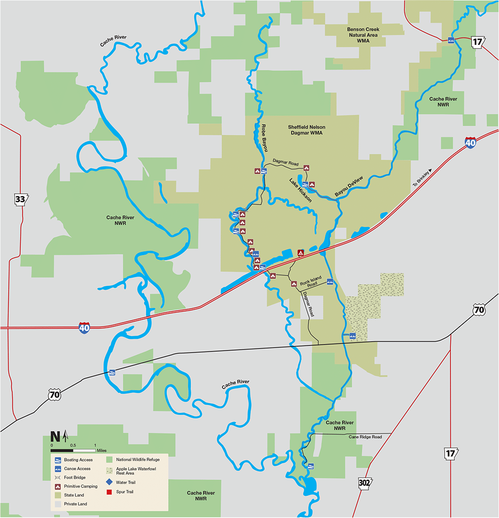
Monroe County
Bayou DeView Water Trail
- From I-40, take exit 216 in Prairie County and travel 4.1 miles north on U.S. Highway 49.
- Turn left on Arkansas Highway 17 and travel 3 miles.
- Cross Bayou DeView and make an immediate left into the Benson Creek Access area.
- From I-40, take exit 193 in Prairie County and go south on U.S. Highway 63 for 2.5 miles.
- Turn east on U.S. Highway 70 and travel 20 miles.
- Turn north on Dagmar Road at the Sheffield Nelson Dagmar Wildlife Management Area sign.
- Bear left at 1.2 and 1.6 miles.
- Travel 7.0 miles; the road ends at Hickson Lake Access.
- From I-40, take exit 193 in Prairie County and go south on U.S. Highway 63 for 2.5 miles.
- Turn east on U.S. Highway 70 and travel 20 miles.
- Turn north on Dagmar Road at the Sheffield Nelson Dagmar Wildlife Management Area sign and go 1.2 miles.
- Turn right at Rock Island Road; the boat launch is 0.6 miles.
- From I-40, take exit 193 in Prairie County and go south on U.S. Highway 63 for 2.5 miles.
- Turn east on U.S. Highway 70 and travel 20.5 miles.
- Turn north at the Apple Lake Waterfowl Rest Area sign.
- The boat launch is 0.1 miles.
- From 1-40, take exit 216 in Prairie County and travel southwest on U.S. Highway 70 for 6 miles.
- Go west on Arkansas Highway 302 for 0.2 miles.
- Turn right on Cane Ridge Road at the Cache River National Wildlife Refuge Bank of Brinkley Tract Access sign.
- Bear left at mile 1.0; the boat launch is at mile 1.7.
Quick Facts
- Download the free Avenza Map app from the App Store on mobile device.
- Choose a trail and tap on the geo-referenced map.
- Tap on the map again and choose “Open in Avenza Maps” or choose “More” and tap on the Avenza Map icon.
- Map is saved in Avenza Map app.
- A blue dot marks your location on the map.
- The trail map uses the phone’s GPS. If cell reception is poor, put phone on airplane mode to conserve power.
- Download the free Avenza Map app from the App Store on mobile device.
- Choose a trail and tap on the geo-referenced map.
- Tap on the three dots in the upper-right corner.
- Choose “Send File” and tap the Avenza Map icon.
- Map is saved in Avenza Map app.
- A blue dot marks your location on the map.
- The trail map uses the phone’s GPS. If cell reception is poor, put phone on airplane mode to conserve power.
Water Level
The gauge height needs to be around 14’ or higher to paddle the trail. The gate on Dagmar Road is closed at 17’. Click here to see the current water level gauge reading for Bayou DeView.
Water Trail Distances
- Benson Creek Access – Hickson Lake Access: 6.5 miles
- Hickson Lake Access – Bayou DeView: 0.8 miles
- Hickson Lake Access – Rock Island Road Access: 2.9 miles
- Rock Island Road Access – Apple Lake Access: 1.5 miles
- Apple Lake Access – Bank of Brinkley Access: 4.3 miles
- Benson Creek Access – Bank of Brinkley Access: 15.2 miles
- Bayou DeView flows north to south..
River Conditions
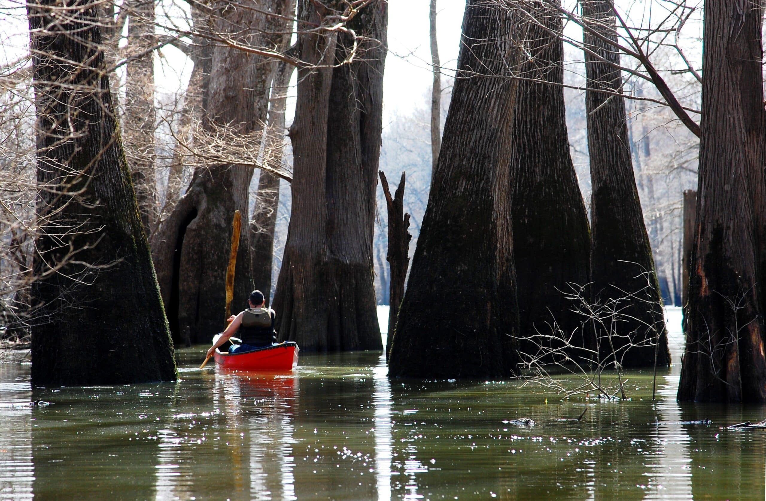
Expect to travel 1-2 miles per hour. Bayou DeView is free of rapids, although high water is dangerous. Always keep a trail marker in sight. The main channel is not always distinct so a GPS unit, map and compass are needed. This map is a representation of the trail; water levels may affect the route. Respect private property marked by fences, signs or purple paint.
Safety
Check weather forecasts and file a float plan; tell someone where you’re going and when you expect to return. Plan your trip so your paddling skills are equal to the water conditions.
Don’t Get a Ticket
According to Arkansas law, children 12 and under must wear a Coast Guard-approved life jacket and anyone on a boat must have one ready to use. Vessels 16 feet and longer must have a throwable life preserver (type IV) aboard. Glass containers are illegal in boats such as canoes and kayaks that can be easily swamped. Paddlers must securely fasten cooler lids, and use attached mesh litter bags and floating holders for beverages.
Emergency Numbers
Monroe County EMS
911
Monroe County Sheriff’s Office
870-747-3811
Stop Poaching Hotline
833-356-0824
AGFC Brinkley Regional Office
833-345-0283
Cache River National Wildlife Refuge
870-347-2614
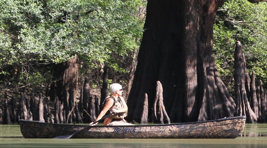
Birds include barred owls, prothonotary warblers, red-headed and pileated woodpeckers, great blue herons, wintering bald eagles and a variety of waterfowl. Watch for beavers, muskrats, deer and raccoons as they travel and feed along the bayou. Cypress-tupelo brakes are scattered throughout low-lying areas; some cypress trees are more than 850 years old. Overcup, water and Nuttall oaks, and sweetgum dominate the forest, although bottomland hardwood forests have become fragmented. The Cache-Lower White Rivers Wetland of International Importance includes Sheffield Nelson Dagmar WMA and Cache River National Wildlife Refuge.
The bayou offers fishing for crappie and bream. Minnows, jigs, spinners and light line are recommended. Fish for catfish on the bottom of the bayou with worms, minnows and stink baits.
Hunters pursue deer, waterfowl and small game on the area. Boating hours are limited during waterfowl seasons. Furbearer trapping is permissible on the WMA. Check the current Arkansas Hunting Guidebook for details and wear hunter orange when appropriate. Leash pets for their safety.
Free campsites (marked by blue paint) are available on Dagmar WMA. The sites, occupied on a first-come, first-served basis, offer no amenities. Camping is not allowed on Cache River NWR.